RGI-TOPO (New! also for RGI 7.0)#
The RGI-TOPO dataset provides a local topography map for each single glacier in the RGI. It was generated with OGGM, and can be downloaded very easily with OGGM from the OGGM Shop (visit our tutorials if you want to learn how to do this!).
Non-OGGM users can access the data by themselves at the following links:
RGI v6.0: https://cluster.klima.uni-bremen.de/~oggm/gdirs/oggm_v1.6/rgitopo/2026.1/RGI62/b_010/L1/
RGI v7.0 Glaciers: https://cluster.klima.uni-bremen.de/~oggm/gdirs/oggm_v1.6/rgitopo/2026.1/RG70G/b_010/L1/
RGI v7.0 Complexes: https://cluster.klima.uni-bremen.de/~oggm/gdirs/oggm_v1.6/rgitopo/2026.1/RG70C/b_010/L1/
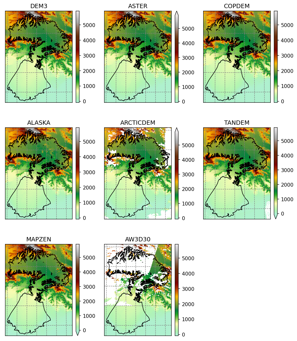
Example of the various RGI-TOPO products at Malaspina glacier#