Useful outputs#
This page lists some datasets that are either generated or used by OGGM and that can be useful to others.
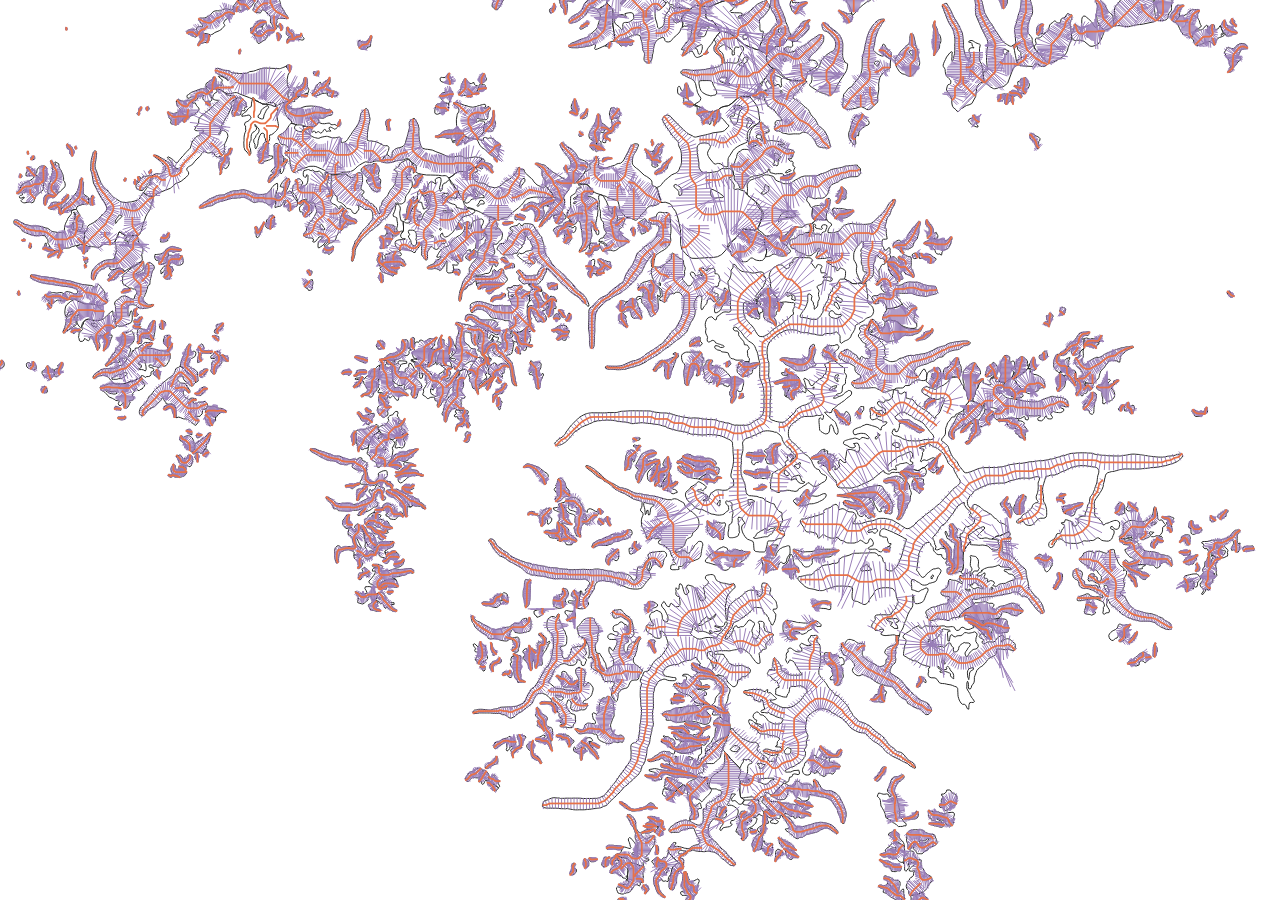
Shapefiles of glacier centerlines, flowlines and widths#
These variables are a standard output of OGGM, and can be useful to many. You will find the files here: https://cluster.klima.uni-bremen.de/~oggm/gdirs/oggm_v1.6/L1-L2_files/centerlines/RGI62/b_010/L2/summary
Note
Note that centerlines computed by OGGM are now a standard product for RGI version 7! Check out the RGI User Guide
The following files are available:
centerlines: the geometrical centerlinescenterlines_smoothed: the geometrical centerlines smoothed to look nicer and guaranteed to match the glacier outlines (not used in the model but useful outside of it)flowlines: the centerlines converted to “flowlines”, i.e. interpolated to a regular grid and where upslope trajectories are croppedgeom_widths: the geometrical intersection of the flowlines’ normals with the glacier outlineswidths: the geometrical widths corrected to reflect the glacier’s elevation-area distribution
If you use these data, please cite Maussion et al. (2019).
Shapefile of OGGM’s flowlines and widths for a subset of RGI region 15#
Useful data tables#
These data are tabular summary from available global datasets:
https://cluster.klima.uni-bremen.de/~oggm/rgi/rgi62_stats.h5: the global RGI stripped from the geometries
https://cluster.klima.uni-bremen.de/~oggm/g2ti/rgi62_itmix_df.h5: ice volumes from Farinotti et al. (2019] in tabular form
https://cluster.klima.uni-bremen.de/~oggm/geodetic_ref_mb/hugonnet_2021_ds_rgi60_pergla_rates_10_20_worldwide_filled.hdf: glacier geodetic mass balance data from Hugonnet et al. (2021) corrected for RGI region 12 and missing glaciers, in tabular form
an example of OGGM output summary from the pre-processed directories. Useful outputs include terminus position, topographical variables, etc.
HDF files can be read with pandas’ read_hdf function.